Colorado Backcountry: Road Work - 02.11.2007

STE and I spent all day Sunday breaking trail, building roads, scouting hut locations and slashing recycled pow. A couple of inches fresh on a firm base and light snow throughout the day made conditions much better than expected. After the 4 hour drive we needed it! Greybird and snowing most of the day and near white out conditions above treeline we stuck to the lower terrain and trees.

SurfTheEarth breaks trail:

Colorado Backcountry: Bookend Couloir, North Traverse Peak (13,035’), Gore Range, 2.9.07

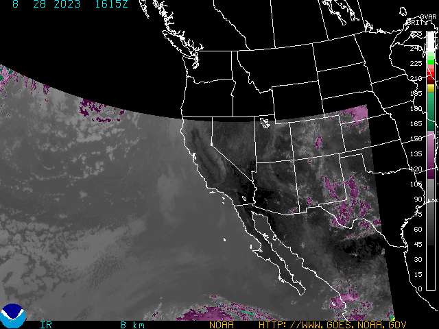
TR: Bookend Couloir, North Traverse Peak (13,035’), Gore Range, 2.9.07
Trip Report: iskibc
JP, iskibc

Aerial view of the Gore Range in October:

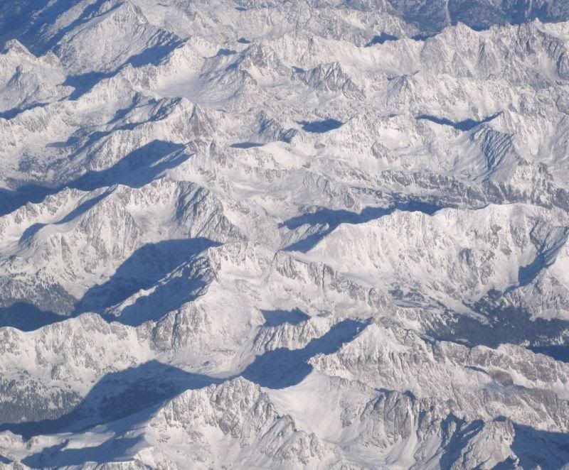
Photo taken by John Spencer.

The Gore Range was named after Sir St. George Gore, a wealthy Irishman who organized a hunting expedition through the Colorado Rockies in the mid 1880s. He was guided by the famous mountain man and storybook frontier Jim Bridger, who showed St. George the beautiful and awe inspiring peaks of the southern Gore Range and lush greens covering the Vail Valley. During their hunting and trapping expedition, they encountered many challenges, with one of them being travel through the Gore Range.

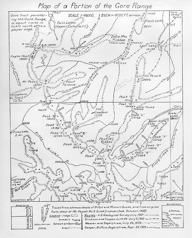
One of the first documented maps of the Gore, 1933:

There is nothing “easy” about this mountain range. Nothing. Long in-and-out approaches with little-to-no trail system and lots of vertical gain (8K-13K+) through rugged and steep terrain make any trip into the Gore a challenging yet rewarding experience. There are 13 trailheads that access the Gore Range. For a small area you think the place would be overrun by skiers, climbers, backpackers, day hikers, peak baggers, etc. That’s not quite the case. Most trails dissipate after the first 2 miles or so, leaving one with a thick and adventurous bushwhack the rest of the way.

Colorado Backcountry: Gore Range - Bighorn Creek Drainage - N. Traverse Peak - 02.09.2007

Some terrain and scenic shots from our Gore trip today. Light snow very early, then bluebird, then graybird plus wind and more snow. Logged 9 miles or so on the split.

Future Projects:

Miner's Cabin.. aka Bighorn Hilton:

Our Line:

Colorado Backcountry: Lines and Skin Tracks - 02.03.2007

GPS Tracks and waypoints in blue and skin track in yellow. Some good turns on a cold cold day. I think wind chill was -30 and the top recorded wind gust was 109 mph. Then we had bluebird with more wind, snow was almost too deep. Very wind blown and loaded in the trees. Bring the pow guns......

Pay Day:

20" Fresh:

Snowmobiling in 70+ MPH wind:

STE kills mom's chile:

JP and STE riding canada style:

Colorado Backcountry: “It Looks Good! I Think I’ll Bring My Buddies..” - 02.03.2007

Another day at one of the local stashes. Big pay day today after 14 days or more of exploring, pain, breaking trail, work, and mapping. Windy as hell but we found a couple of pockets with a little less wind. Deep heavy snow was the norm for the day, wind loaded conditions and lots of slab breaks.

1st light:

STE and Karl:

STE and the Mushroom:

STE rips tight trees:

JP on the huck:

JP hero slash:

Mom's homemade chile:

Wind loaded level 9:

Slidey:

Colorado Backcountry: No Snow, It’s Still Good - 01.28.2007

Another day of work in the backcountry, one of our local stashes finally pays out. Pow4Brains, SurfTheEarth and I took the sleds out for some personal chairlift action and found great snow on north facing aspects below treeline. We weren't expecting much but very happy when we took lap after lap of fresh hero powder through the trees. After we had 8 or so laps each we got tired of crossing our own tracks and decided to move on... good thing we did.

Spent the rest of the afternoon riding around on the sleds, scouting a few waypoints in real life and riding even more fresh snow on some lower altitude north facing steeps. Located a great spot to setup the Kifaru for a weekend.

New Project:

13k:

Pow4Brains:

SurfTheEarth:

JP:

STE:

Syndicate content